Before your visit
- Start
- Main car park and trail information board, reached through the park entrance near Bryansford.
- Access
- The short Blue Arboretum Path has gentle gradients and firm surfaces with some loose material. River and mountain trails have different terrain.
- Dogs
- Keep dogs under control, clean up and use leads where signs or staff require.
- Facilities
- Accessible parking, toilets and picnic facilities are listed. Check opening and vehicle charges with Forest Service.
Checked 9 October 2026. Forest Service: Tollymore Forest Park · Forest Service: forests with facilities for disabled people · Forest Service: walking in forests · Forest Service recreation charges
For current opening, charges and access, check the operator before travelling. Bring what you need rather than relying on refreshments being open.
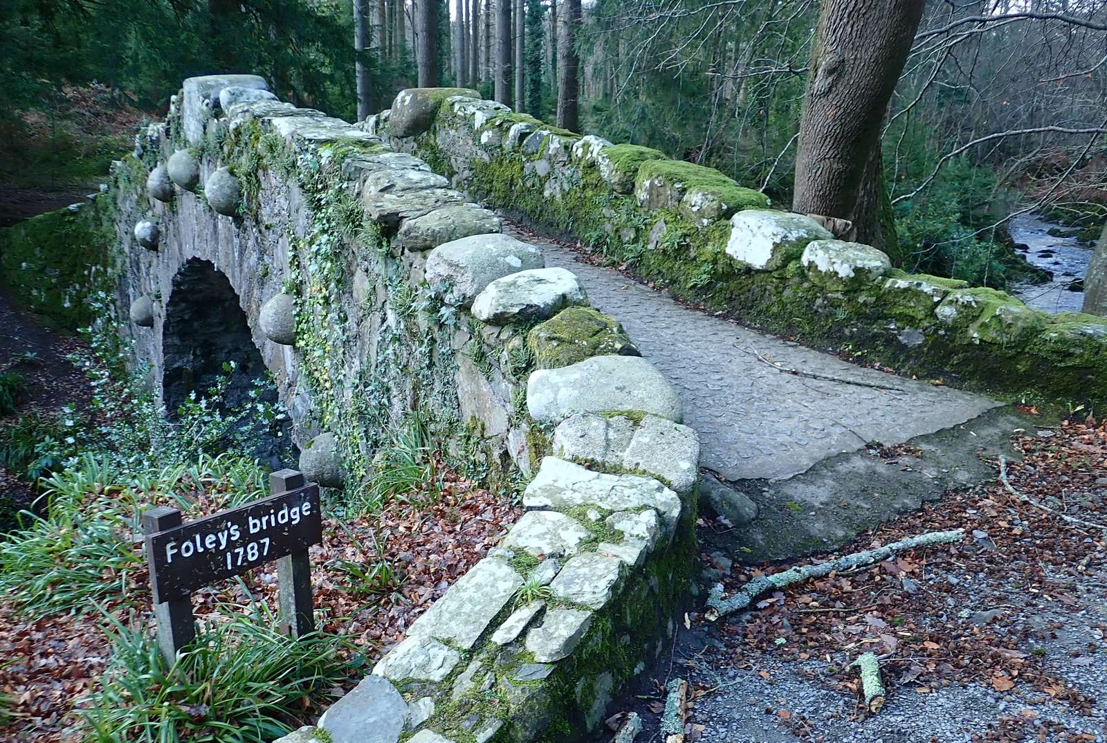
The Shimna River winds through Tollymore’s woodland, past bridges and riverside scenery. Choose a short arboretum walk, a river trail or a longer forest and hillside outing.
Planting in the arboretum began in 1752 as part of a Georgian landscape. Its tree collection gives you plenty to look at even on a shorter visit.
- Setting
- Foot of the Mournes, near Newcastle
- Arboretum history
- Planting began in 1752
What to look out for
- Shimna River and stone bridges
- Arboretum with eighteenth-century origins
- Published trails of different lengths
Find your bearings
Open in OpenStreetMap ↗See where this place sits in the Mourne landscape before planning your visit.
From the coast to the high ground.
© OpenStreetMap contributors · Map data & privacy
Loading the map connects to OpenStreetMap. Pins show locations, not a walking route or permission to enter.
Plan your visit
Read the Forest Service trail information and current notices. Use the information-board map, suitable footwear and signed routes; forestry work or weather can affect access.
Visitor information & access →
Sources & further reading
Checked 2026-10-08: nidirect / Forest Service.
01
A short visit or a longer walk
Which Tollymore trail should I choose?
Choose the blue Arboretum Path for a short tree-filled loop, the red River Trail for bridges and riverside woodland, or the black Mountain Trail for a longer hillside outing.
The guide’s WalkNI distances are approximately 0.6 km for the arboretum, 5.3 km for the River Trail and 14.3 km for the full Mountain and Drinns circuit. The Drinns is an extension, not a separate short version of the full circuit. Begin with the trail board in the main car park and follow the colour of your chosen route.
Read the source: WalkNI — Tollymore Arboretum Path · WalkNI — Tollymore River Trail · WalkNI — Tollymore Mountain and Drinns · Forest Service / nidirect — Tollymore Forest Park
How long are Tollymore’s trails, and how much time should I allow?
Pick a trail by its full circuit distance and the ground underfoot. The arboretum is the short option; the full Mountain and Drinns route is a substantial walk.
Leave time for river stops, photographs and the return to the car park. The red River Trail has steps, roots and slopes, while the black trails have steeper, broken ground. Use the park trail board for the route you plan to follow and make sure you have enough daylight for its complete distance.
Read the source: Forest Service / nidirect — Tollymore Forest Park · Forest Service / nidirect — Walking in forests · WalkNI — Tollymore River Trail · WalkNI — Tollymore Mountain and Drinns
Can I visit Tollymore without a long walk?
Yes. The blue Arboretum Path is a short circular walk from the main car park, so you can enjoy the tree collection without committing to the longer river or hillside trails.
It has gentle slopes, firm surfaces and some loose material. Read the information board before leaving; for particular mobility needs, check the park’s current accessibility information. If you choose an out-and-back section instead, keep track of where you turn and return by the same permitted path.
Read the source: WalkNI — Tollymore Arboretum Path · Forest Service / nidirect — Tollymore Forest Park · Forest Service / nidirect — Walking in forests
Where do I check current opening hours, charges and closures?
Use Forest Service’s Tollymore page and recreation-charge page for Tollymore, and NI Water’s Silent Valley visitor page for the reservoir park.
Check before travelling, then follow signs and barriers when you arrive. Forest work, severe weather or repairs can change access. At Silent Valley, vehicle entry is through the main Head Road gates; admission charges and seasonal opening hours apply. Plan to complete the walk and leave within the current opening period.
Explore Newcastle and nearby places →
Read the source: Forest Service / nidirect — Tollymore Forest Park · Forest Service / nidirect — Walking in forests · NI Water — Silent Valley visitor information and current notices
Researched 9 October 2026. Opening, charges, services and access can change. Check the linked operator again close to your visit.
 Make more of your visitPlan the rest of your visitRead the guide →