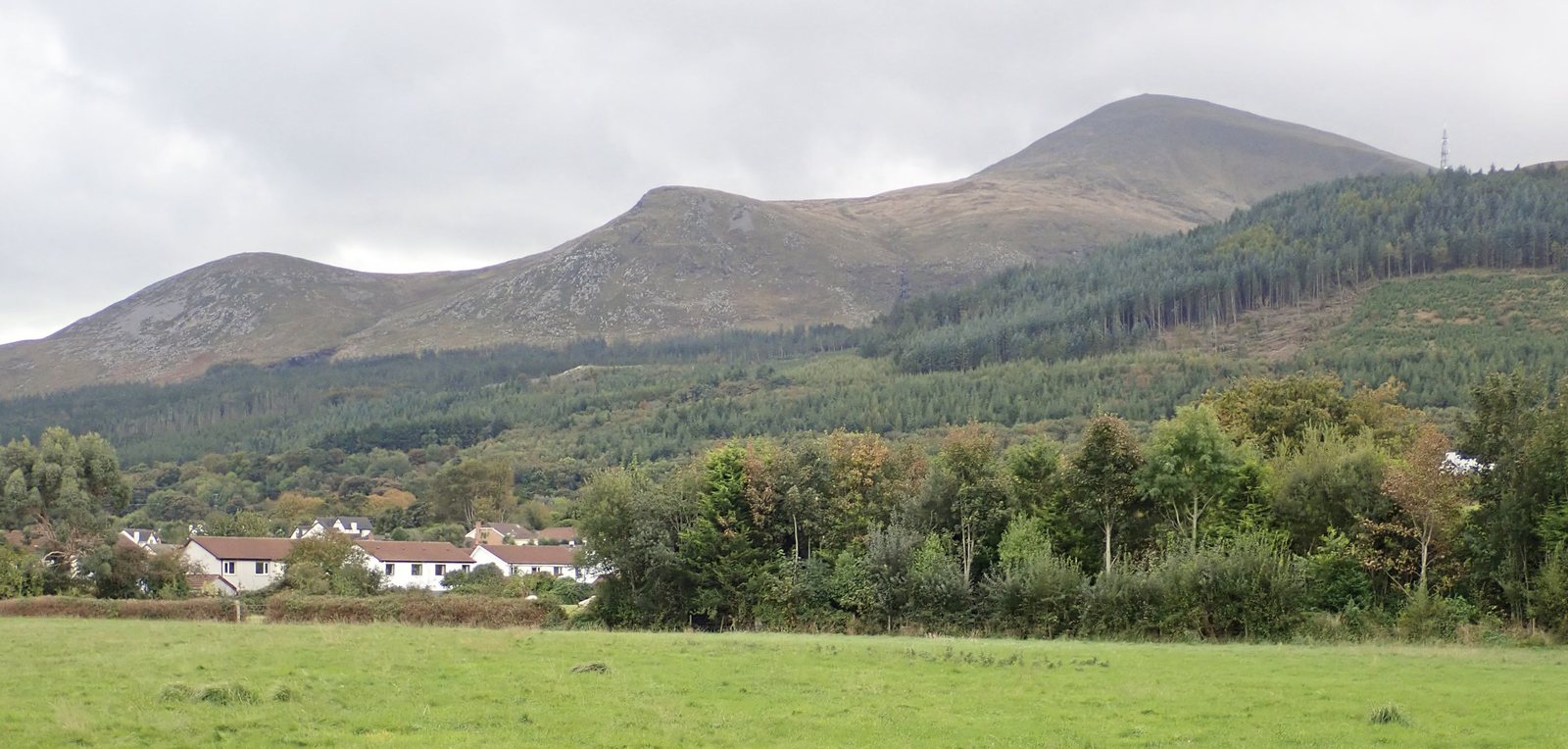
Is this the Donard walk for you?
Start beside the sea in Newcastle and climb through riverside woodland into an open mountain valley. The Glen River route reaches the saddle with Commedagh before the steep final ascent beside the Mourne Wall. Return by the same approach.
This is a very strenuous mountain walk, with rough paths and exposed ground. Choose it for a demanding summit day; for an easier outing, explore forest and lakeside walks. Deciding between peaks? Compare Donard, Binnian and Hare’s Gap.
Starting point: Donard Park, Newcastle
Start at Donard Park car park, at the southern end of Newcastle, County Down. Check the route map for the entrance and follow access signs when you arrive.
About Donard Park → · Travel & parking →
- Distance
- ~9.3 km return
- Difficulty
- Very strenuous
- Route
- Out and back
- Walking time
- Allow about 6 hours return at a leisurely pace; experienced walkers may take around 4. Conditions and stops can make it longer. Read the timing notes
Start & landmarks on the map
Open in OpenStreetMap ↗See Donard Park’s starting point, Donard Bridge, the ice house and the summit. Read the climbing guide for the journey between them; take a current walking map for the climb.
From the coast to the high ground.
© OpenStreetMap contributors · Map data & privacy
Loading the map connects to OpenStreetMap. Pins show locations, not a walking route or permission to enter.
Landmarks along the way
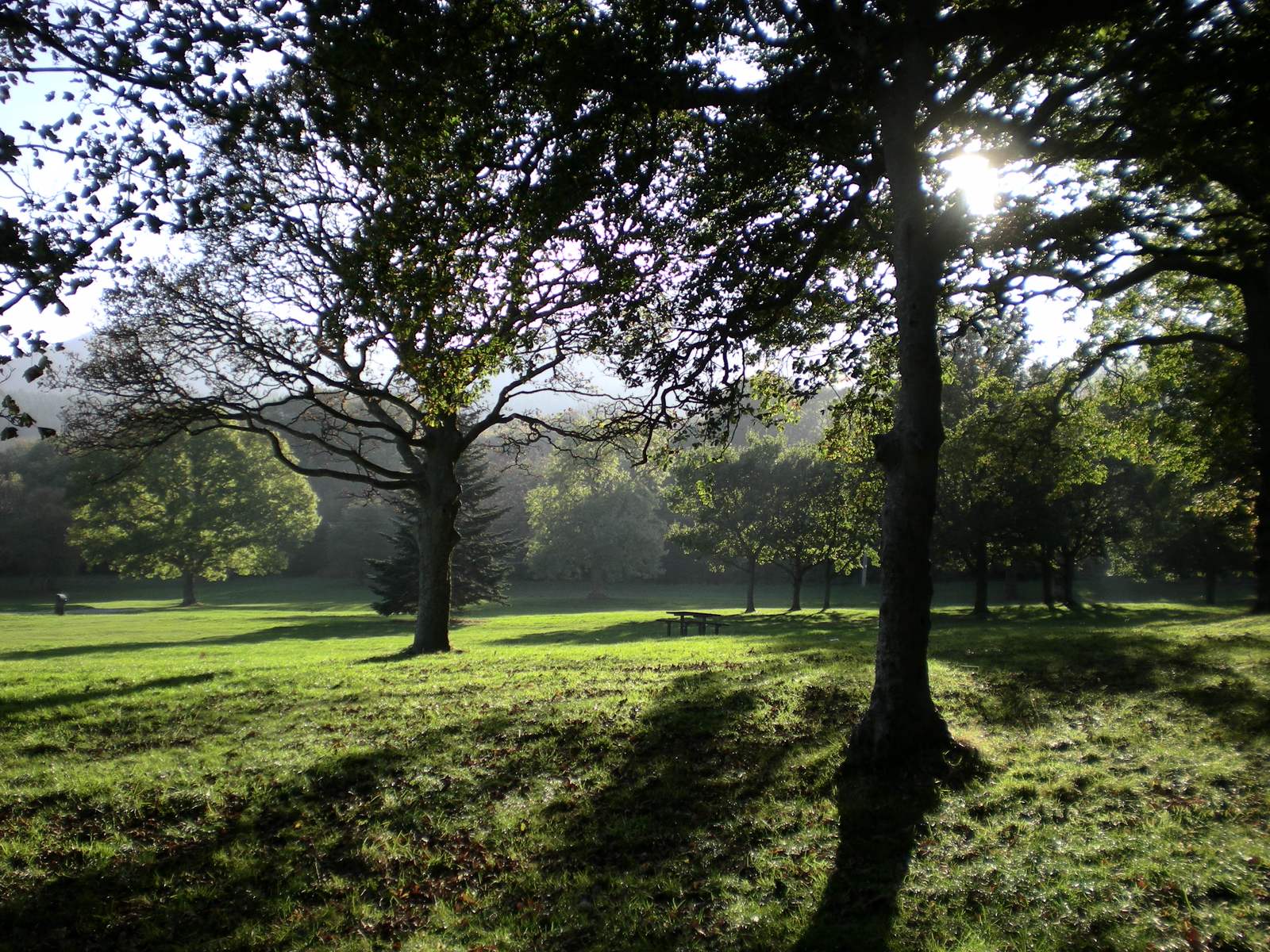
Donard Park and the forest
From Donard Park, the climb enters Donard Wood beside the Glen River. The woodland makes an enjoyable first part of the walk, whether you plan to reach the summit or turn back sooner.
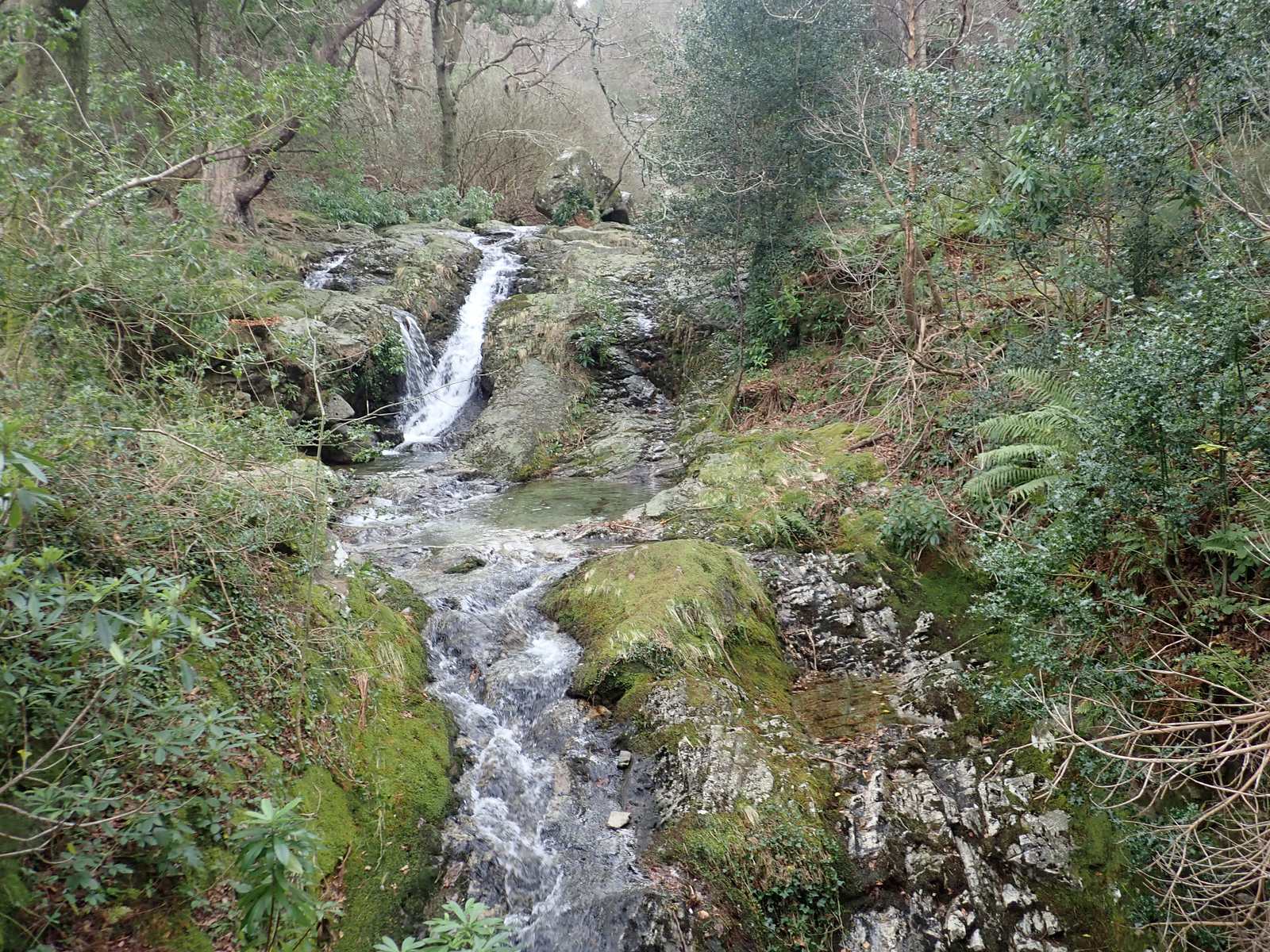
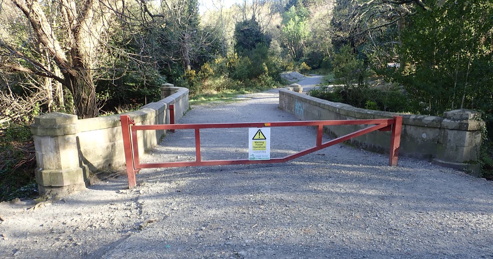
Glen River and its bridges
Woodland paths follow the Glen River, with bridges along the way. Beyond the forest, the track becomes rougher. Take care around overhanging riverbanks and crossings, and follow your map and route directions.
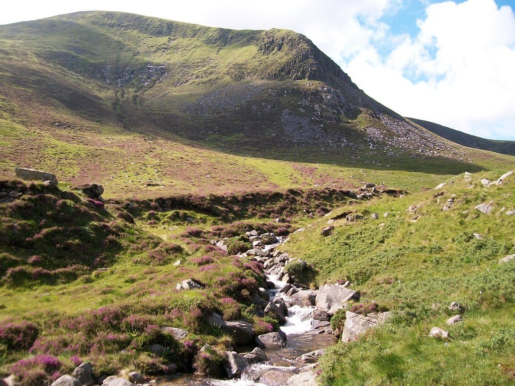
The open Glen River valley
Beyond the trees, the valley opens into mountain ground. The climb continues towards the saddle between Slieve Donard and Slieve Commedagh.
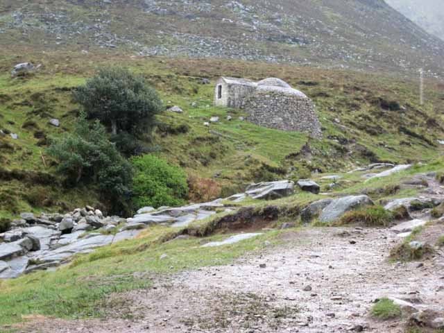
The old ice house
Look for the small brick-and-granite ice house in the valley. It once stored ice before electric refrigeration and was restored in 1996–97.
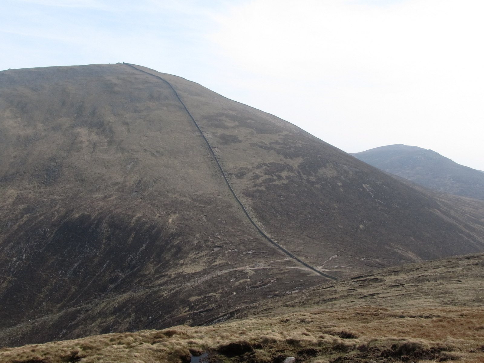
The saddle and Mourne Wall
The saddle is the low point between Donard and Commedagh, where the Glen River approach meets the Mourne Wall. Pause here to check the weather, how everyone is feeling and the climb still ahead.
The final ascent
From the saddle, the route climbs steeply beside the Mourne Wall to Donard’s summit. The mountain is exposed. Keep away from the Eagle Rocks cliffs on the northern side.
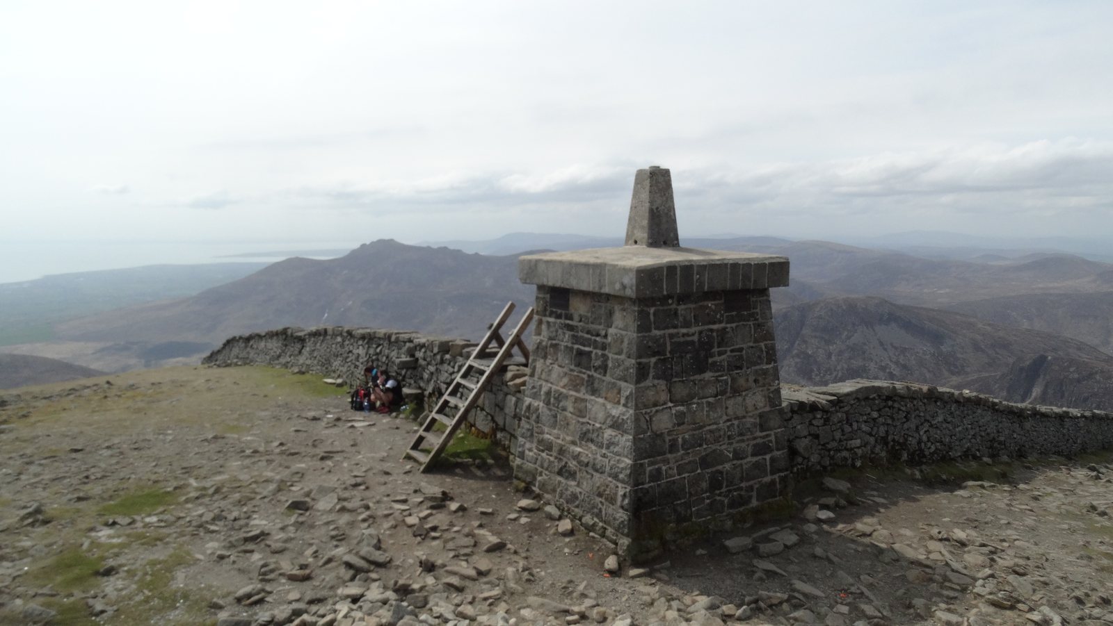
Summit cairns and the water story
Two prehistoric cairns stand on the summit: the Great Cairn is a passage tomb, and the Lesser Cairn dates from the Bronze Age. Treat these remains with care. The Mourne Wall, built between 1904 and 1922, enclosed the water catchment.
The return to Newcastle
Return by the same Glen River approach: descend beside the wall to the saddle, then follow the valley and woodland back to Donard Park. Leave enough daylight and energy for the descent. You can turn back before the summit if the weather or the group’s pace calls for it.
Prepare for the mountain
Forest paths become rough mountain paths with a steep final climb. River crossings and exposed ground require care; avoid the Eagle Rocks cliffs. Mountain navigation and suitable equipment are essential.
Compare the high-ground forecast with Newcastle, check official warnings and leave room to change your plan. Bring navigation equipment and the skills to use it, warm and waterproof clothing, food, water and a headtorch.
Full preparation guide → · Compare the forecast →
After the walk
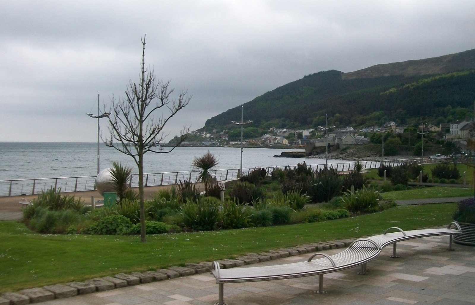
Newcastle’s beach and promenade are close to the mountain’s base. Leave time for a promenade stroll or a stop in town. Check opening times before counting on a shop or café for supplies.
Explore Newcastle & the local area →
Sources & route details
Distance covers the return journey, approximately twice WalkNI’s 2.9-mile one-way route. Route measurements can differ with the starting point; use the linked route map.
Checked 2026-10-08: WalkNI: Slieve Donard via Glen River · National Trust: The Mournes · OutmoreNI: Glen River · Hearth Historic Buildings Trust: the ice house · National Trust: history of Slieve Donard.
01
Plan the climb and return
How long does it take to climb Slieve Donard and return?
Allow about six hours for the return walk at a leisurely pace. Experienced walkers may take around four hours, but weather, stops and your group’s pace can make the outing longer.
The Glen River route covers approximately 9.3 km including the return. Treat the time as a planning estimate, not a deadline: leave enough daylight and energy for the descent.
Sources for this answer
Is Slieve Donard suitable for beginners?
Slieve Donard is a demanding mountain walk, graded very strenuous by WalkNI. It is a big step up from a gentle forest or lakeside stroll.
The route climbs from Newcastle through woodland to open mountain terrain, with a steep final ascent beside the Mourne Wall. Build up fitness and navigation skills first; if this is your first mountain day, consider going with an experienced leader. Choose the short Tollymore Arboretum Path or Castlewellan Lakeside Walk when you want an easier starting point.
Sources for this answer
Where does the Glen River route start, and where can I park?
Start at Donard Park car park at the southern end of Newcastle, County Down. WalkNI gives grid reference J375305.
Follow the town’s one-way system to the south end of Main Street, then use the Glen River path from the park. Check car-park signs when you arrive. WalkNI lists parking and toilets at Donard Park, with refreshments in Newcastle.
Sources for this answer
Read the source: WalkNI — Slieve Donard via Glen River
What footwear, equipment and navigation do I need for Donard?
Wear sturdy, well-fitting footwear with a treaded sole and bring warm layers plus a waterproof and windproof outer layer. Carry a map and compass you know how to use.
Pack enough food and water, hat and gloves, a head torch with spare batteries, whistle, first-aid supplies and emergency shelter. A charged phone or GPS can help, but batteries and signal can fail. Tell someone your route and expected return. Check the mountain forecast before leaving and adjust the plan as conditions or the group’s energy change.
Sources for this answer
Read the source: Mourne Mountain Rescue Team — Mountain safety · Met Office — Mountain safety
Is the Slieve Donard distance one way or return?
The approximately 9.3 km shown in this guide includes the climb from Donard Park and the return by the same Glen River route. It is not 9.3 km each way.
WalkNI lists 2.9 miles for the linear route to the summit. We double that one-way distance and round it to show the full outing. Starting elsewhere or adding another summit changes the distance.
Compare Donard, Binnian and Hare’s Gap →
Sources for this answer
Read the source: WalkNI — Slieve Donard via Glen River
Is the Glen River route the same as Bloody Bridge?
No. The Glen River walk starts at Donard Park in Newcastle. Bloody Bridge is a separate starting point on the A2 coast road south of town.
Check the named start when arranging parking, a lift or public transport. The landmarks and return journey in this guide describe the Donard Park approach.
Sources for this answer
Read the source: National Trust — Visiting the Mournes · WalkNI — Slieve Donard via Glen River
What makes the Glen River climb worth doing?
The scenery changes as you climb: riverside woodland gives way to the open valley, then the Mourne Wall leads towards the summit. Along the way, the old ice house and summit cairns add stories to the landscape.
In clear weather, views reach back towards Newcastle, Murlough and the County Down coast. Cloud can hide those views, so choose your day for the mountain conditions as well as the prospect of a photograph.
Discover Slieve Donard’s summit and history →
Sources for this answer
Read the source: National Trust — Visiting the Mournes · WalkNI — Slieve Donard via Glen River
Researched 15 October 2026. Opening, charges, services and access can change. Check the linked operator again close to your visit.
 Make more of your visitPlan the rest of your visitRead the guide →